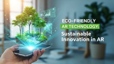
AR Navigation Systems merge augmented reality, AI, and mapping technologies to revolutionize urban and indoor navigation, offering immersive guidance, efficiency, and personalized experiences for commuters, shoppers, and businesses alike, shaping the future of connected mobility.
Introduction to AR Navigation Systems
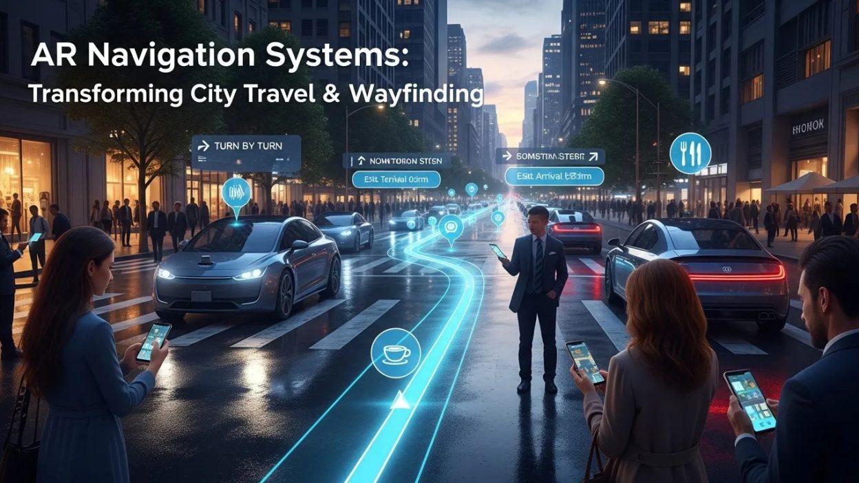
Navigating complex urban environments has always been a challenge, whether for daily commuters or tourists exploring a new city. Traditional maps and GPS have served us well, but they often lack the immersive guidance that modern travelers crave. This is where AR Navigation Systems come into play, bridging the gap between digital mapping and real-world orientation. By overlaying virtual directions onto the physical environment, these systems allow users to move seamlessly through cities, malls, airports, and other spaces with unparalleled confidence.
The adoption of AR Navigation Systems is fueled by rapid advancements in mobile technology, computer vision, and AI-powered interfaces. Smartphones, smart glasses, and other wearable devices have become gateways for augmented reality experiences, enabling navigation solutions that are interactive, adaptive, and context-aware. Users no longer need to stare at a 2D map; instead, digital arrows, labels, and cues appear in their real-world view, transforming the way people explore their surroundings.
How AR Navigation Systems Work
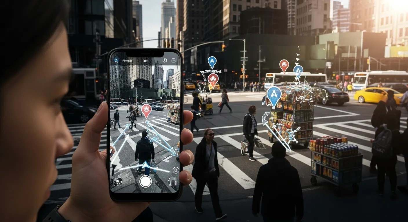
At the heart of any AR Navigation System is a sophisticated integration of hardware and software. These systems rely on sensors, cameras, GPS, and advanced algorithms to interpret the physical environment accurately. One of the key enabling technologies is Computer Vision in AR, which allows the system to recognize landmarks, obstacles, and pathways in real time. By analyzing visual data captured by a device, the system can generate precise overlays that align with the user’s perspective.
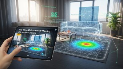
In addition to computer vision, AR Environment Mapping plays a critical role. This involves creating a detailed 3D representation of the surrounding area, including walls, streets, doors, and points of interest. With accurate environment mapping, AR Navigation Systems can provide turn-by-turn guidance, highlight nearby facilities, and even suggest optimal routes based on foot traffic or accessibility. This technology is particularly useful in indoor environments, such as airports or shopping malls, where GPS signals may be weak or unavailable.
Another exciting aspect of modern AR Navigation Systems is the integration of AI-Powered AR Vision. AI algorithms enhance the system’s ability to anticipate user behavior, predict congestion points, and adapt guidance dynamically. For example, if a pathway is crowded or blocked, the system can automatically suggest an alternate route, making navigation not only more efficient but also safer.
Benefits of AR Navigation Systems for Urban Mobility

Implementing AR Navigation Systems in urban spaces offers a range of benefits:
-
Improved Wayfinding – Users can find their destinations faster without constantly checking a map or asking for directions.
-
Enhanced Safety – Real-time visual cues reduce the need to look down at a phone, keeping users aware of their surroundings.
-
Personalized Experience – Routes can be optimized based on user preferences, whether it’s avoiding stairs, taking scenic paths, or finding eco-friendly options.
-
Integration with Smart Cities – Eco-Friendly AR Technology can help urban planners monitor foot traffic patterns and reduce congestion in busy zones.
By leveraging these benefits, AR Navigation Systems are reshaping the concept of mobility, encouraging users to explore their cities more confidently and efficiently.
Key Applications of AR Navigation Systems
AR Navigation Systems are no longer limited to outdoor use; their applications span multiple domains:
-
Urban Tourism – Tourists can receive historical information, reviews, and cultural insights directly overlaid on landmarks.
-
Indoor Navigation – Large complexes such as airports, museums, and hospitals benefit from indoor AR navigation where GPS fails.
-
Retail & Shopping – Stores can guide shoppers to products, promotions, or checkout counters, integrating AI Conversational Commerce for personalized recommendations.
-
Transportation Hubs – Subway stations, bus terminals, and train stations can implement AR wayfinding to ease commuter flow.
These applications demonstrate the versatility of AR Navigation Systems, making them valuable for both businesses and everyday users. Interestingly, even industries like marketing are tapping into AR navigation indirectly. For instance, Chatbots in B2B Marketing are being integrated with AR apps to provide interactive support while users navigate complex venues.
Technologies Powering AR Navigation Systems
The rise of AR Navigation Systems is closely tied to the rapid advancement of several cutting-edge technologies. These systems rely on a combination of sensors, software, and AI to create seamless navigation experiences.
Sensor Fusion and Spatial Awareness
Modern devices equipped with AR Navigation Systems use a technique called sensor fusion, which combines data from accelerometers, gyroscopes, magnetometers, and cameras. This integration allows the system to accurately determine the user’s position and orientation in both indoor and outdoor spaces. By continuously analyzing spatial data, AR navigation provides smooth and precise directional overlays in real time.
The Role of Computer Vision in AR
One of the most important technologies enabling these systems is Computer Vision in AR. Computer vision algorithms detect objects, landmarks, and obstacles in the environment. They analyze visual inputs from cameras to recognize streets, doorways, or even signage, helping AR navigation provide contextually relevant guidance. By leveraging this technology, AR Navigation Systems can accurately align digital directions with the real-world environment, reducing navigation errors.
AR Environment Mapping for Complex Spaces
Another critical component is AR Environment Mapping, which creates a 3D representation of a space. This mapping allows the system to overlay directional arrows, markers, and points of interest directly onto the environment, providing users with intuitive guidance. Whether navigating a crowded shopping mall or a complex airport terminal, AR environment mapping ensures that every turn is clear and actionable.
AI-Powered AR Vision Enhancements
The integration of AI-Powered AR Vision further improves the usability of AR Navigation Systems. AI algorithms analyze patterns in user behavior, pedestrian traffic, and environmental conditions to provide adaptive guidance. For instance, if a path becomes congested, the system can suggest alternative routes or highlight less crowded areas, making navigation safer and more efficient. This predictive capability sets AR navigation apart from traditional GPS systems, offering a more responsive and intelligent experience.
Devices Supporting AR Navigation Systems
AR Navigation Systems are increasingly accessible due to the proliferation of devices capable of delivering augmented reality experiences.
Smartphones and Tablets
Most users interact with AR navigation through smartphones or tablets, which combine high-resolution cameras, powerful processors, and GPS connectivity. These devices are ideal for casual navigation, providing instant AR overlays that guide users through streets, shopping areas, and indoor facilities.
Smart Glasses and Wearables
Wearable technology such as smart glasses brings hands-free AR navigation to the forefront. With a transparent display projecting directions onto the user’s field of view, users can maintain situational awareness while following guidance. Devices like these are particularly useful in professional environments, such as warehouses, hospitals, and manufacturing plants.
Integration with Other Smart Systems
AR Navigation Systems are also beginning to integrate with broader smart infrastructure. For example, eco-conscious cities leverage Eco-Friendly AR Technology to optimize pedestrian routes, reduce congestion, and minimize energy usage in transportation networks. This integration underscores how AR navigation is not just a user-facing tool but also a critical component of smart urban planning.
AR Navigation Systems in Everyday Life
The versatility of AR Navigation Systems is evident in everyday scenarios, ranging from casual use to professional applications.
Urban Mobility and Commuting
Commuters benefit from AR-guided routes that simplify walking, cycling, or using public transit. With visual overlays indicating bus stops, subway entrances, and transfer points, users can reach their destinations efficiently without constantly checking their phones.
Retail and E-Commerce Integration
Retail spaces are adopting AR Navigation Systems to enhance customer experiences. Stores guide shoppers to products or promotions, creating a seamless journey through physical spaces. By combining this with AI Conversational Commerce, retailers can offer personalized recommendations, answer queries in real time, and improve overall engagement.
Business and Event Management
In large-scale events, exhibitions, or conferences, AR navigation assists attendees in finding booths, conference rooms, and facilities quickly. Chatbots in B2B Marketing are sometimes integrated with these AR systems to provide additional support, such as scheduling meetings or delivering interactive information, creating a highly connected and informative environment.
Challenges in Implementing AR Navigation Systems
Despite the rapid growth and benefits of AR Navigation Systems, several challenges remain:
-
Technical Limitations: Accurate AR overlays require high-quality cameras, sensors, and processing power, which may not be available on all devices.
-
GPS and Connectivity Issues: While GPS works well outdoors, indoor navigation requires alternative positioning systems and reliable connectivity.
-
User Adoption: Not all users are familiar with AR technology, and some may find wearable devices cumbersome.
-
Data Privacy: AR navigation involves collecting location and environmental data, raising concerns about user privacy and security.
Overcoming these challenges is essential to unlock the full potential of AR Navigation Systems, and ongoing research in AI, computer vision, and AR mapping continues to improve both accuracy and user experience.
Future Trends in AR Navigation Systems
The future of AR Navigation Systems is incredibly promising, as new technologies and applications continue to emerge. As cities become smarter and users demand more immersive experiences, AR navigation is set to revolutionize the way we move through both urban and indoor environments.
Integration with Smart Cities
Smart cities rely on advanced data analytics, IoT sensors, and AI algorithms to optimize infrastructure and improve quality of life. AR Navigation Systems fit perfectly into this ecosystem, providing real-time information on traffic flow, pedestrian density, and public transport availability. Moreover, cities adopting Eco-Friendly AR Technology can encourage walking or cycling routes, reduce carbon emissions, and create sustainable urban mobility solutions.
Personalized Navigation Experiences
AI and machine learning are shaping the next generation of AR Navigation Systems. By analyzing user preferences and travel patterns, systems can now offer personalized routes, recommendations for nearby attractions, or notifications about delays. This customization transforms navigation from a purely functional tool into a personal travel assistant, making journeys smoother and more enjoyable.
Enhanced Indoor Navigation
Indoor navigation remains a key growth area for AR Navigation Systems. Airports, hospitals, shopping malls, and large corporate campuses are increasingly using AR to guide visitors efficiently. By combining AR Environment Mapping with AI-powered analytics, users can find rooms, gates, or products without the frustration of getting lost. This is particularly useful for first-time visitors or in facilities with complex layouts.
Comparative Advantages of AR Navigation Systems
When compared to traditional GPS or paper maps, AR Navigation Systems offer several clear advantages:
| Feature | Traditional GPS | AR Navigation Systems |
|---|---|---|
| Visual Guidance | Limited 2D maps | Real-time overlays in real world |
| Indoor Use | Poor or unavailable | Effective with AR mapping |
| Personalized Routes | Minimal | AI-Powered AR Vision provides tailored paths |
| User Engagement | Low | High – interactive and immersive |
| Safety | Users distracted by phones | Hands-free guidance with smart glasses |
As the table shows, AR Navigation Systems provide enhanced interactivity, safety, and personalization, making them superior for modern navigation needs.
AR Navigation Systems in Retail and Commerce
Retailers are increasingly leveraging AR Navigation Systems to enhance the customer journey. By guiding shoppers to specific products, promotions, or store sections, these systems create a seamless and engaging experience. Integrating AI Conversational Commerce allows users to ask questions, receive recommendations, and even complete transactions without leaving the AR interface.
Moreover, large retail complexes can benefit from data collected through AR navigation to optimize store layouts, improve foot traffic flow, and increase sales. The combination of AR and AI ensures that customers not only find what they need but also enjoy a personalized, efficient shopping experience.
AR Navigation in Marketing and B2B Applications
Beyond consumer use, AR Navigation Systems are becoming valuable tools for marketing and B2B applications. Event organizers, trade shows, and corporate campuses utilize AR to help attendees locate meeting rooms, booths, or facilities effortlessly. Integrating Chatbots in B2B Marketing allows users to interact with brand representatives, schedule appointments, or access detailed product information while navigating complex venues.
This approach enhances engagement, improves attendee satisfaction, and ensures that businesses can deliver meaningful interactions at scale. The combination of AR navigation and conversational AI is redefining how companies approach both marketing and operational efficiency.
Real-World Case Studies
Several cities and companies have successfully implemented AR Navigation Systems, showcasing their potential:
-
Tourist Cities: AR apps in major urban centers provide immersive walking tours, highlighting landmarks, historical facts, and cultural points of interest.
-
Airports: Global airports use AR navigation to direct passengers to gates, lounges, and amenities, reducing delays and congestion.
-
Retail Chains: Large department stores employ AR guidance to improve product discovery and integrate conversational commerce tools for a seamless shopping experience.
-
Universities & Hospitals: Indoor AR mapping helps students and patients navigate sprawling campuses without confusion, saving time and improving accessibility.
These examples illustrate the versatility and transformative impact of AR Navigation Systems across industries and daily life.
Technical Challenges and Device Comparisons

While AR Navigation Systems offer groundbreaking experiences, implementing them comes with several technical challenges. One key issue is device compatibility. High-quality AR overlays require devices with advanced cameras, sensors, and processing power. Older smartphones or low-end wearables may struggle to render AR directions accurately, leading to delays or misalignment.
Indoor navigation presents another challenge. GPS signals are weak or unavailable inside buildings, so AR navigation relies heavily on AR Environment Mapping and additional positioning technologies like Wi-Fi triangulation or Bluetooth beacons. Ensuring seamless navigation in these environments requires sophisticated calibration and regular updates to the digital maps.
Battery consumption is also a concern. Continuous camera use, sensor tracking, and real-time rendering can drain mobile devices quickly. Developers are now exploring Eco-Friendly AR Technology to optimize energy use without compromising user experience. This not only benefits device longevity but also aligns with sustainable technology practices in urban planning.
Device Comparisons
| Device Type | Pros | Cons |
|---|---|---|
| Smartphones/Tablets | Widely available, easy to use | Battery drain, hand-held only |
| Smart Glasses | Hands-free, immersive | Expensive, limited adoption |
| AR Wearables | Specialized environments (warehouses, hospitals) | High cost, requires training |
Smart glasses and wearables are particularly effective in professional or complex spaces, while smartphones remain the most accessible option for general users. Selecting the right device depends on the use case, environment, and user familiarity with AR technology.
User Adoption and Experience
The success of AR Navigation Systems depends on user adoption. Some users may feel intimidated by AR interfaces or reluctant to rely on wearable devices. Clear tutorials, intuitive interfaces, and responsive AI guidance are essential to improve engagement. Integrating AI-Powered AR Vision ensures the system adapts to user behavior, making navigation easier and more intuitive over time.
Moreover, industries like retail, events, and corporate environments are experimenting with Chatbots in B2B Marketing integrated into AR apps. These chatbots provide contextual assistance while users navigate, enhancing both usability and engagement without overwhelming the interface.
Despite these challenges, the continuous evolution of sensors, AI algorithms, and AR mapping technologies is rapidly overcoming technical barriers, making AR Navigation Systems more reliable, accessible, and practical for everyday use.
Conclusion
AR Navigation Systems are transforming how we move through cities, indoor spaces, and complex environments. By leveraging Computer Vision in AR, AR Environment Mapping, and AI-Powered AR Vision, these systems offer intuitive, real-time guidance that surpasses traditional maps. From urban commuting to retail, events, and corporate settings, AR navigation enhances safety, efficiency, and user experience. Integrating features like Eco-Friendly AR Technology, AI Conversational Commerce, and Chatbots in B2B Marketing further expands their practical applications. As device capabilities improve and user adoption grows, AR Navigation Systems will become an essential tool for smarter, more connected, and sustainable mobility worldwide.
Frequently Asked Questions (FAQ)
What are AR Navigation Systems?
AR Navigation Systems overlay digital directions onto the real world, guiding users through streets, buildings, or complex spaces in real time.
How do AR Navigation Systems work?
They use sensors, cameras, GPS, Computer Vision in AR, and AR Environment Mapping to analyze surroundings and provide accurate, immersive guidance.
Which devices support AR Navigation Systems?
Smartphones, tablets, smart glasses, and specialized wearables all support AR navigation, depending on use cases and environment.
Are AR Navigation Systems eco-friendly?
Many incorporate Eco-Friendly AR Technology to optimize energy use and support sustainable urban mobility solutions.
How is AI integrated into AR navigation?
AI-Powered AR Vision and AI Conversational Commerce enhance route optimization, user personalization, and interactive support for businesses.